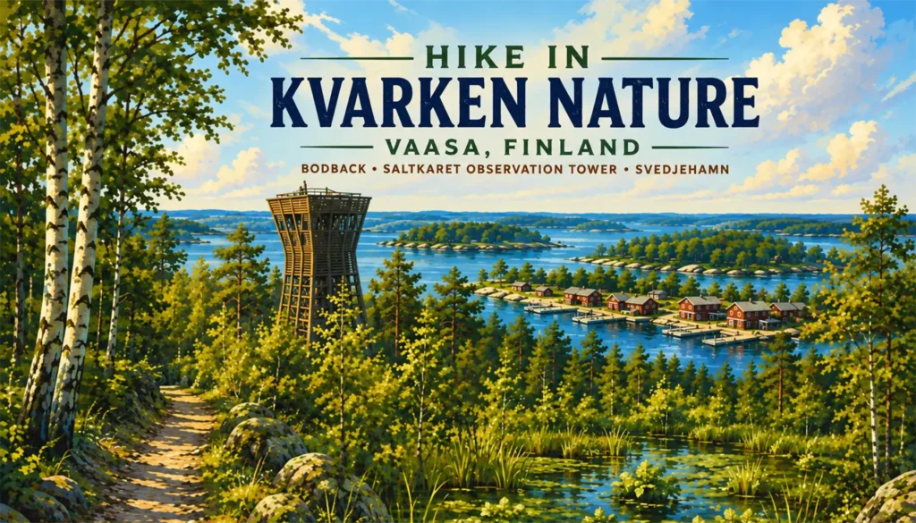
✘ Vaasa, Finland • June 22, 2026
⌖ Forest Trails, Historic Fishing Harbors and a Landscape Still Rising from the Sea
Tour Route: Vaasa → Raippaluoto Bridge → Björköby → Svedjehamn → Bodvattnet Runt Nature Trail → Bodback → Saltkaret Observation Tower → Svedjehamn → Vaasa
Our coach left the port with considerably fewer passengers than seats, perhaps 60 percent full, and initially passed through Vaasa before turning toward the islands of the Kvarken Archipelago. The drive to Svedjehamn took roughly 40 minutes, giving our guide time to introduce the geological process that would define nearly everything we saw during the excursion.
The Kvarken Archipelago and Sweden’s High Coast form a transboundary UNESCO World Heritage Site recognized for exceptionally rapid post-glacial land uplift. During the last Ice Age, the enormous weight of the continental ice sheet pressed down the Earth’s crust. As the ice retreated, the land began rebounding, a process that continues today. In the Kvarken, that continuing rise brings new land above the water, joins islands together, and gradually converts shallow bays into enclosed lakes and wetlands.
Our guide connected that geology directly to Vaasa. As shorelines became progressively shallower, the city repeatedly had to shift its harbor operations toward deeper water. The same process would become visible on a much smaller scale later in the excursion at Bodback.
On the way into the archipelago, the coach crossed the Raippaluoto Bridge, a 1,045-meter road bridge opened in 1997. It remains Finland’s longest bridge carrying automobile traffic, with pylons rising more than 82 meters above sea level.
Beyond the bridge, development thinned and the landscape became increasingly rural. Red wooden houses, forest, water, and small island communities accompanied the remainder of the drive through Raippaluoto and Björköby before we reached Svedjehamn.
① Svedjehamn & Bodvattnet Runt Nature Trail
⚲ Svedjehamn and Björköby, Korsholm, Finland
⧗ ~1½ hours of walking including trail stops
The coach stopped at Svedjehamn, a small fishing harbor surrounded by red wooden boathouses, docks, reeds, and low wooded terrain. Café Salteriet stood near the waterfront, along with an information building and the trailhead.
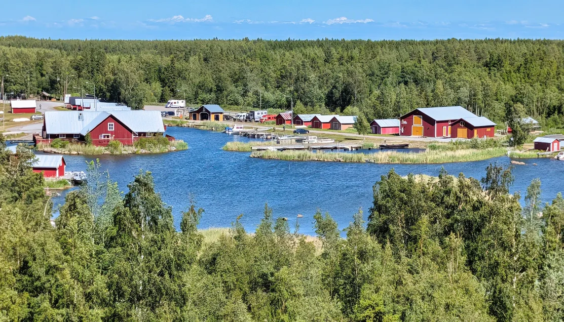
The cluster of traditional red boathouses reflects Svedjehamn’s long connection to fishing, with the sheltered inlet providing direct access to the shallow waters of the Kvarken Archipelago.
After a short restroom and orientation break, the group gathered and began walking. Trail signs pointed toward Saltkaret, Långgrund, and Stora Segelsören, but another marker soon confirmed the route we were following: Bodvattnet Runt.
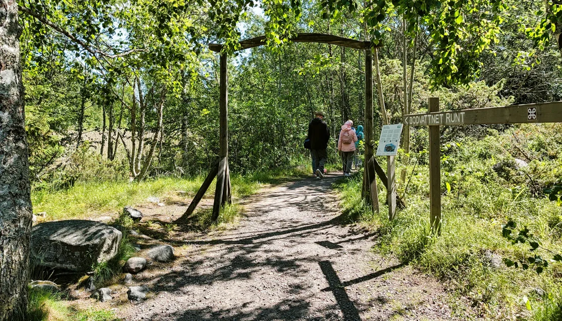
Bodvattnet Runt means “around Bodvattnet,” a name derived from the shallow coastal waters enclosed within this changing land-uplift landscape.
The complete Bodvattnet Runt loop is approximately four kilometers, or about 2½ miles, and official visitor information estimates roughly 1½ hours to complete it in summer. It is partly rocky, an important qualification that proved more meaningful as the hike progressed.
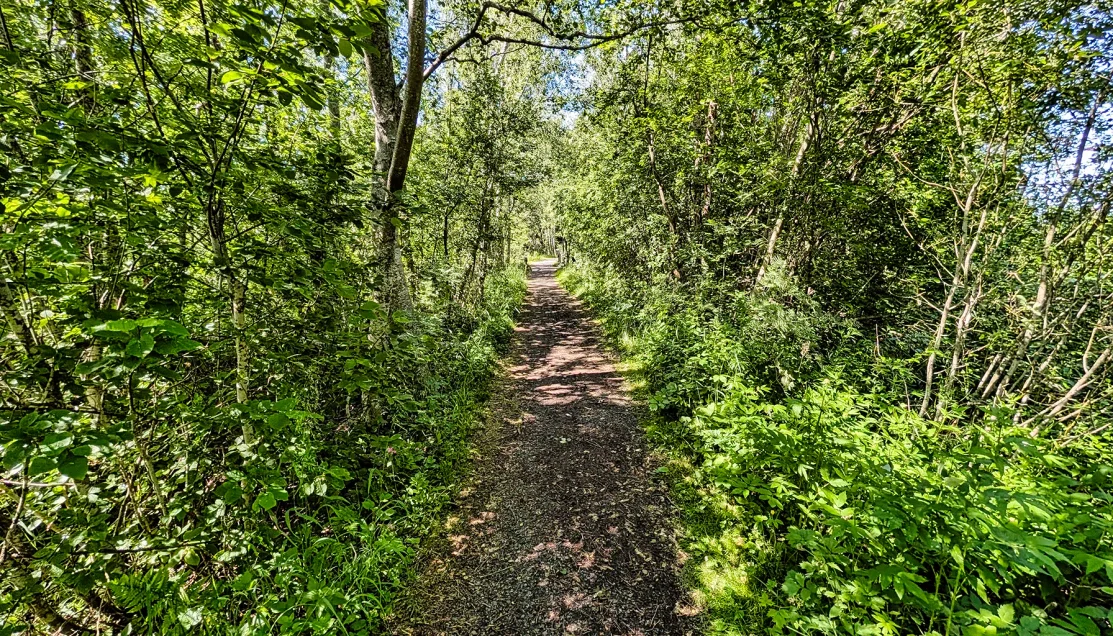
Much of the forest here occupies geologically young ground, exposed from the sea as continuing post-glacial uplift gradually reshapes the archipelago.
Initially, the walk was easy to enjoy. Dirt and loose-gravel paths passed through birch and mixed woodland, with scattered buildings, small streams, wetlands, and shallow stretches of water appearing between the trees. Moss-covered rocks and large boulders punctuated the forest floor, while grasses and other vegetation became dense near the wetter sections.
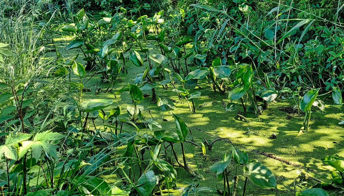
Shallow wetlands such as these occupy a transitional landscape where former coastal water is gradually becoming dry land as the Kvarken continues to rise.
The vegetation itself is part of the land-uplift story. As new shoreline emerges, grasses establish themselves first. Bushes and gray alder follow, while birch and spruce occupy higher ground that has been out of the water longer. The result is a landscape in which the age of the land can partly be read through the vegetation growing on it.
Water repeatedly appeared beside the trail, but these were not all conventional lakes or bays. In the Kvarken, land uplift progressively cuts shallow sea bays away from open water. A partially enclosed bay is known as a flad. As its connection with the sea becomes increasingly restricted, it becomes a gloe, and once completely separated, a gloe-lake. Because the Kvarken is so shallow, that progression can occur over just a few decades.
These protected, nutrient-rich waters also provide important spawning habitat for fish including pike and perch and feeding and nesting habitat for birds. Trail interpretation discussed the white-tailed eagle, whose wingspan can exceed two meters, although seeing one was not part of our own experience that afternoon.
Bodback: The Harbor the Land Left Behind
Farther along the trail, we reached the quiet water beside Bodback, once the fishing harbor for Björköby.
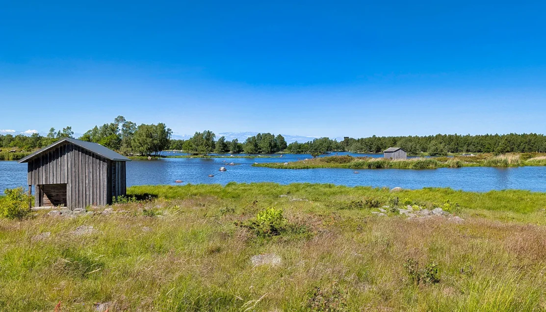
The Saltkaret observation tower is just visible above the distant treeline, providing a useful sense of how the trail continues beyond the former harbor.
The contrast between its appearance today and its former use was striking. Interpretive signs explained that there were once as many as 130 boathouses and storehouses around the harbor and nearby islands. Boats, fishing equipment, barrels, sails, and nets were stored here, while jetties, footbridges, and drying structures crowded a waterfront that bustled when fishing boats returned with Baltic herring.
Land uplift gradually changed all of that.
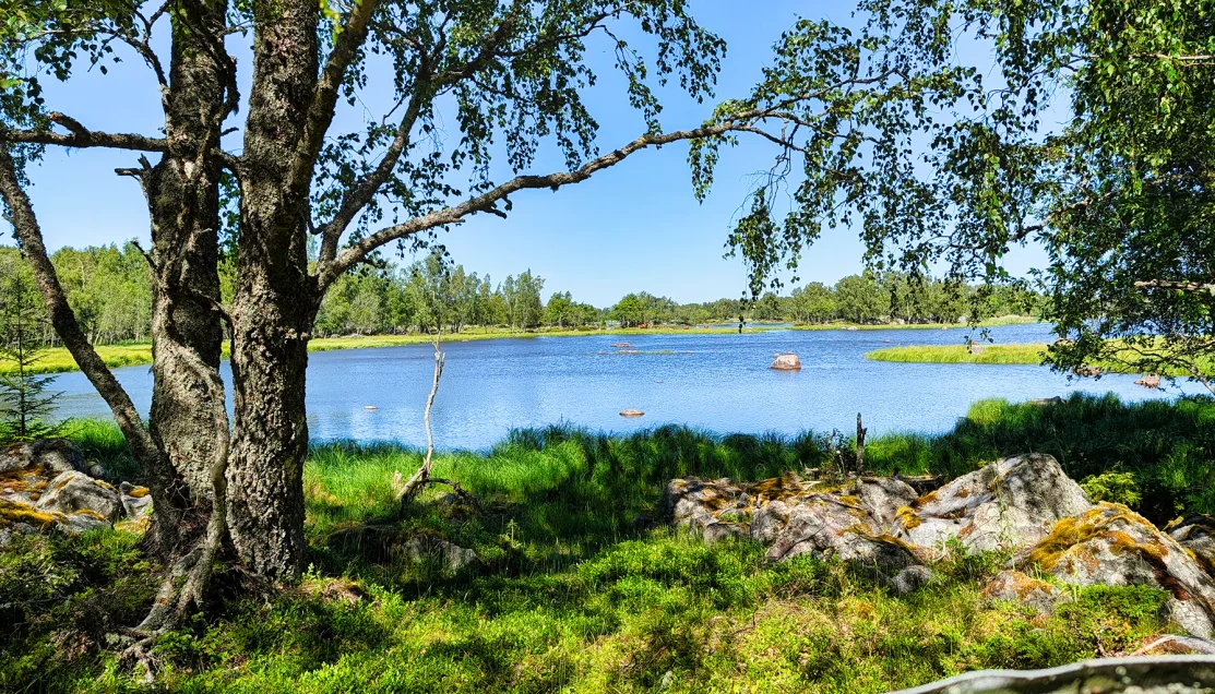
The maze of rock, vegetation, and shallow water is characteristic of the Kvarken, where even small changes in elevation can determine whether ground remains submerged or becomes part of the emerging shoreline.
As Bodvattnet became increasingly shallow, the old harbor could no longer serve its original purpose. During the first half of the 20th century, harbor activity shifted toward Svedjehamn, and many of the sheds were moved there as well. Today only a small brook connects the former harbor area with the sea, making Bodback one of the clearest human-scale demonstrations of what the geological process has done to this landscape.
The group also paused near a monument recalling another chapter of Björkö’s relationship with the sea.
For centuries, local residents carried travelers and mail across the Kvarken toward Sweden, a difficult obligation in an environment of shifting ice, weather, and shallow rocky water. In 1617, King Gustav II Adolf granted the people of Björkö tax relief and exemption from military service in return for maintaining this transportation obligation. Boats and equipment used for the crossing were once stored here at Bodback. A modern post-rowing tradition later developed to commemorate those historic journeys, using traditional boats to recreate the crossing between the Finnish and Swedish sides of the Kvarken.
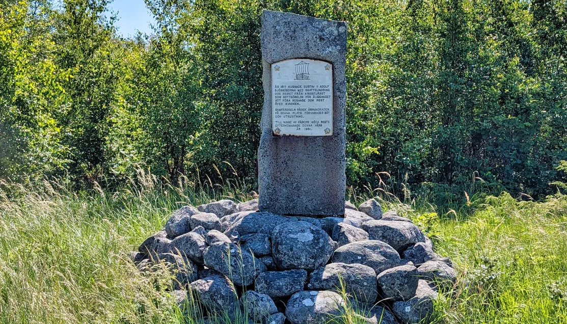
Erected by descendants in 1951, the monument commemorates the arduous Kvarken crossings made by earlier generations of Björkö residents, whose transportation obligations dated back at least to a royal decree of 1617.
When the Trail Changed
The character of the walk changed considerably after the easier opening sections.
Parts of the route became rougher, with awkward rocks and irregular footing that required noticeably more attention. Some rocks were positioned in ways that made a poorly placed step an easy way to twist an ankle. The official description of the trail as partly rocky is accurate, but the practical effect was greater in these sections than the relatively flat landscape might suggest.
At approximately the same time, the mosquitoes became relentless.
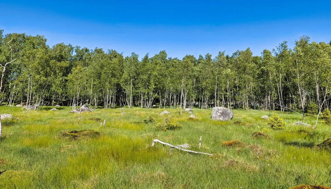
The mix of wetland grasses, moss-covered hummocks, exposed boulders, and young birch woodland marks the transition between recently emerged low ground and older, more established terrain.
This was far beyond occasionally swatting away an insect. For roughly 15 minutes, there were so many mosquitoes around us that the purpose of the walk temporarily shifted from enjoying the landscape to simply continuing toward the tower. The photographic record effectively stops during this portion of the hike because there was little incentive to stop moving long enough to take pictures.
Long pants and a jacket turned out to be fortunate choices. Several people wearing shorts or with their arms exposed had considerably less protection. Combined with the rough footing, the mosquitoes transformed what had been a very pleasant nature walk into the most difficult section of the excursion.
Eventually the forest began to open, trail interpretation signs reappeared, and Saltkaret was finally close ahead. Almost as quickly as they had overwhelmed the trail, the mosquitoes largely disappeared.
② Saltkaret Observation Tower
⚲ Svedjehamn, Björköby, Finland
⧗ ~15–20 minutes including climb, viewing, and descent
Saltkaret rises approximately 20 meters above the surrounding terrain, with a succession of wooden stairways climbing through its open timber structure to the observation platform.
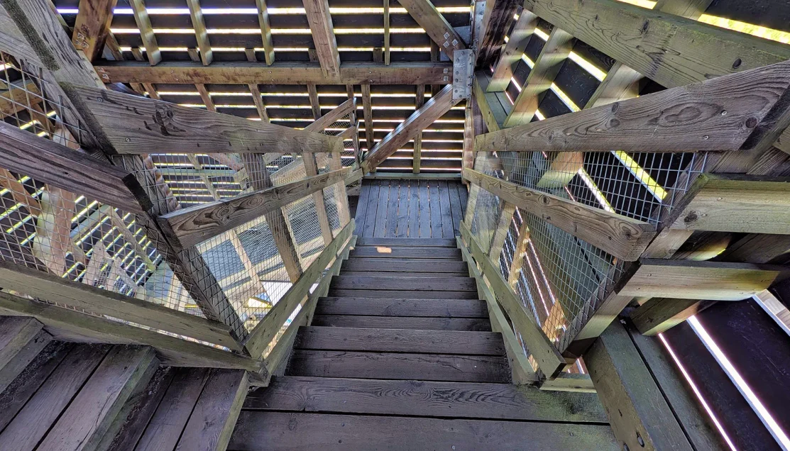
The wooden stairway winds upward through Saltkaret’s heavy timber framework, with daylight filtering through the slatted exterior as the climb continues toward the observation deck.
The stairs make this a separate physical consideration from the hike itself. Travelers uncomfortable with sustained stair climbing can remain below as reaching the upper platform requires several flights and a continued climb through the tower.
At the top, the scattered geography we had been walking through finally became understandable as a whole.
Forest, shallow waterways, reeds, rocky islands, and low strips of land spread outward in every direction. The Kvarken contains thousands of low islands along with distinctive De Geer moraines, parallel ridges deposited as the continental ice sheet retreated. UNESCO specifically identifies these formations and the continuing uplift as defining characteristics of the World Heritage Site.
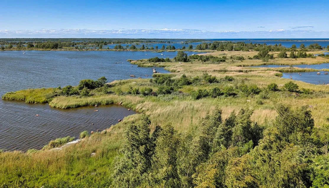
The patchwork of reeds, shallow channels, exposed rocks, and low islands reveals different stages in Kvarken’s transition from seabed to dry land.
One of the interpretive displays provided an unusually effective way to comprehend the scale of the process. Saltkaret’s 20-meter height represents approximately 2,000 years of land uplift. Around the beginning of the Common Era, the land in this area stood roughly one tower-height lower relative to the sea than it does today.
From above, the flads and other shallow waterways were also easier to recognize. As land uplift raises the moraine ridges relative to sea level, these shallow bays become increasingly constricted until their connections with the sea eventually close.
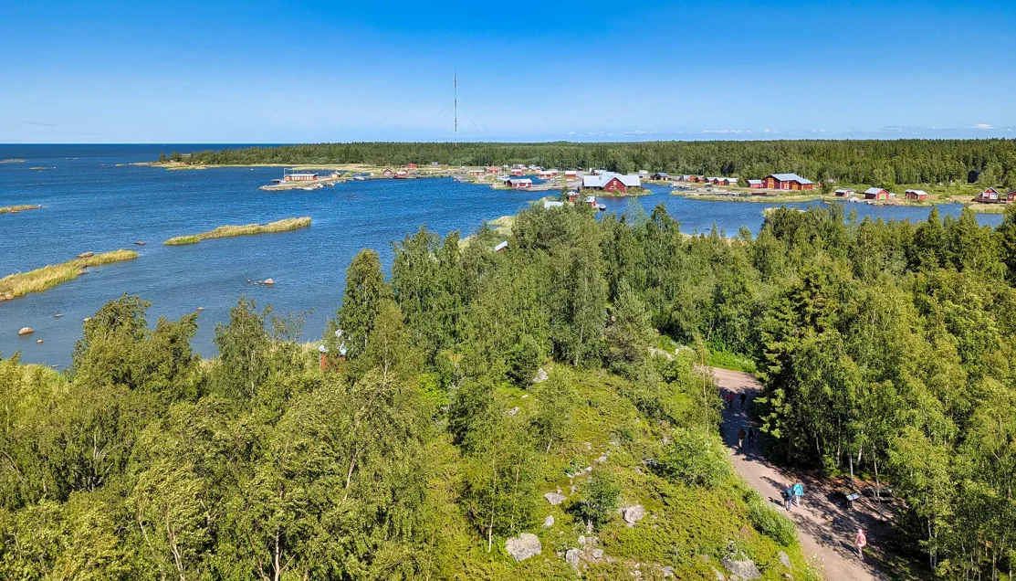
The elevated view shows how Svedjehamn occupies the narrow boundary between forest and shallow coastal water, with its red harbor buildings concentrated along the protected shoreline.
Looking back toward Svedjehamn, clusters of red harbor buildings appeared between water and forest. Elsewhere, the landscape dissolved into low islands and channels extending toward the horizon.
After spending a short period on the platform, we worked our way back down the tower and followed the final portion of the trail toward Svedjehamn.
③ Archipelago Bread at Svedjehamn
⚲ Café Salteriet, Svedjehamn, Finland
⧗ ~30 minutes
Back at the harbor, we entered Café Salteriet for the refreshment included with the excursion. The café occupies a building constructed by local villagers around 1920 for processing and salting fish, an operation that continued here for much of the 20th century. Its present name, Salteriet, reflects that history, essentially meaning the saltery or the salting house.
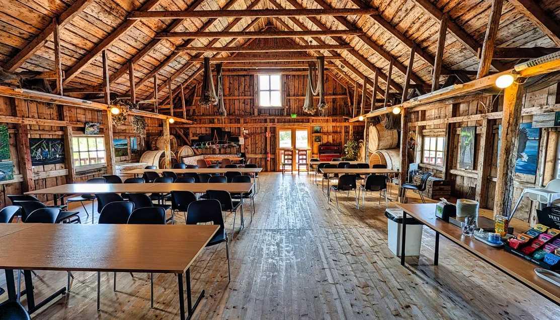
The building’s open rafters, heavy timber supports, plank walls and broad wooden floor preserve much of the utilitarian character of its earlier working life.
Our refreshment was a distinctly Finnish combination of archipelago bread topped with salmon, served with horseradish, lettuce, pickled red onion, lemon and dill, along with tea. The dark bread, also known as malt bread, is a traditional specialty of Finland’s coastal and archipelago communities. Dense and slightly sweet, with the characteristic richness of malt, it provided a flavorful contrast to the salmon and sharp horseradish.
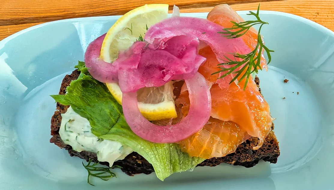
The dark malt bread provides the traditional base for salmon, with pickled red onion, dill, lemon and horseradish adding the sharper flavors commonly paired with fish in Nordic coastal cooking.
Our conversation at the café also brought an unexpected postscript to the hike. I mentioned to one of the staff members just how intense the mosquitoes had been along the trail, particularly during the long stretch through the forest. She listened with a little amusement before telling us, quite matter-of-factly, that what we had experienced was mild compared with the mosquitoes farther north.
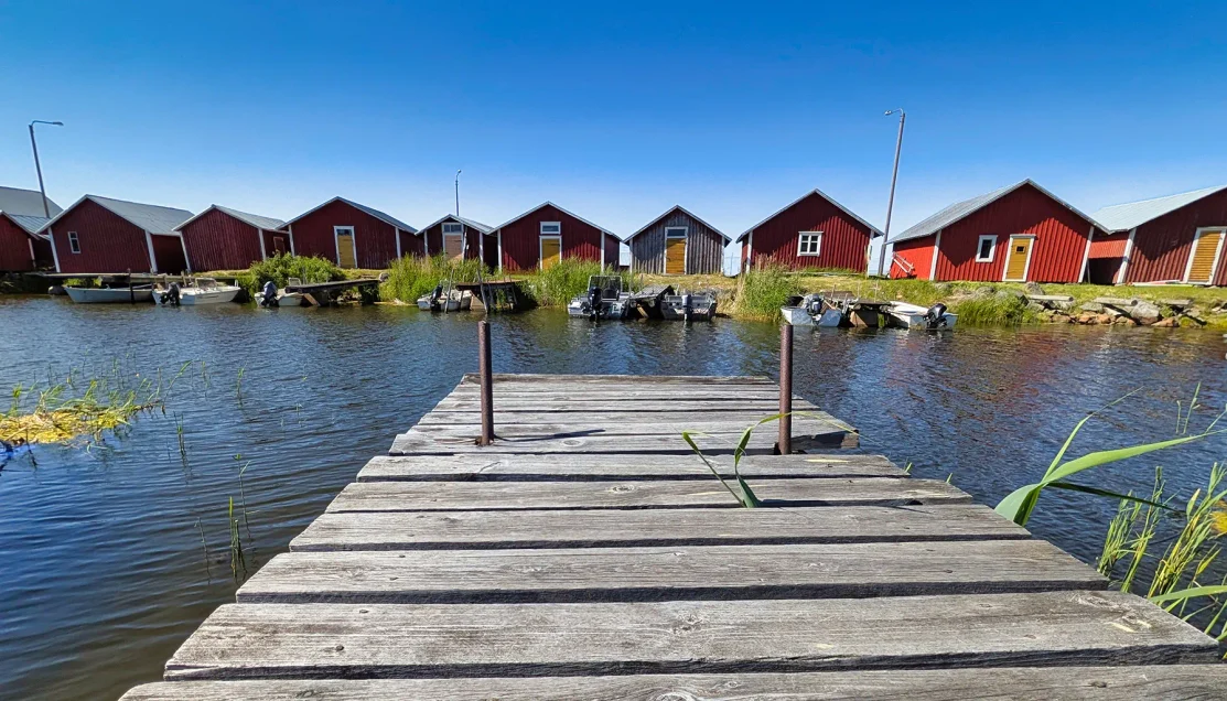
Traditional waterfront boathouses stand directly along the sheltered inlet, a layout that once allowed fishermen to move boats, nets, and catches between the water and their storage buildings.
After finishing our refreshment, we had about ten minutes before it was time to return to the coach. We used the remaining time to explore several of the old wooden boathouses near the harbor. From the water, their weathered walls still looked much as they might have during Svedjehamn’s fishing days, while entrances on the road-facing side opened into a handful of small shops selling local arts, crafts, and souvenirs.
Return to Vaasa
After our brief time exploring the harbor, we boarded the coach again and left Svedjehamn.
The return took us back across the islands and over the Raippaluoto Bridge before approaching Vaasa by a somewhat different route. Our guide continued pointing out features of the region along the way, including the forests and the changing relationship between land and water.
The coach continued through Vaasa and returned us to the pier.
☑ Who Is This Tour Best For?
- Travelers interested in natural history and geology – The excursion is centered on seeing post-glacial land uplift in the landscape, with Bodback and Saltkaret making the process especially easy to understand.
- Active walkers comfortable with uneven terrain – The route is not mountainous, but several stretches were rough and rocky enough to require careful footing and presented a real ankle-twisting risk.
- Travelers willing to climb for the best view – Saltkaret’s upper platform provides the clearest overview of the Kvarken landscape, but reaching it requires multiple flights of wooden stairs.
- Visitors prepared for summer insects – Mosquitoes became severe for roughly 15 minutes during our June hike, making insect repellent and clothing that covers arms and legs especially useful.
- Travelers who enjoy nature with local history – Bodback, the historic postal crossings, and Svedjehamn show how land uplift has influenced fishing, transportation, and settlement.
⊞ Tour Summary
- Tour Name: Hike in Kvarken Nature
- Port: Vaasa, Finland
- Ship: Oceania Insignia
- Total Duration: ~4 hours
- Primary Focus: Kvarken Archipelago geology, nature, and land uplift
- Main Stops: Svedjehamn and Bodvattnet Runt Nature Trail, including Bodback; Saltkaret Observation Tower; Café Salteriet
- Refreshment Included: Archipelago bread with salmon and hot tea at Café Salteriet
- Drive-By Highlight: Raippaluoto Bridge
▣ Activity Summary
- Walking Time: Approximately 1½ hours on the Bodvattnet Runt route, including trail stops
- Terrain: Dirt and loose-gravel forest paths with substantially rougher rocky sections
- Accessibility: Not well suited to travelers with significant walking, balance, ankle, knee, or mobility limitations
- Pacing: Guided at the beginning, with portions of the trail allowing participants to continue at their own comfortable pace before regrouping
- Stairs: Multiple flights inside Saltkaret Observation Tower for those climbing to the upper platform
- Mosquito Exposure: Severe during one forest section on our June visit; insect repellent and clothing covering the arms and legs are strongly recommended
- Restrooms: Available at Svedjehamn before the hike
- Meal Logistics: Seated light refreshment at Café Salteriet after the walking portion

Related Northern Europe Travel: Explore more Northern European cruise ports and shore excursions in our complete regional guide.
→ Northern Europe Cruises & Shore Excursions Guide
© OceansAfoot