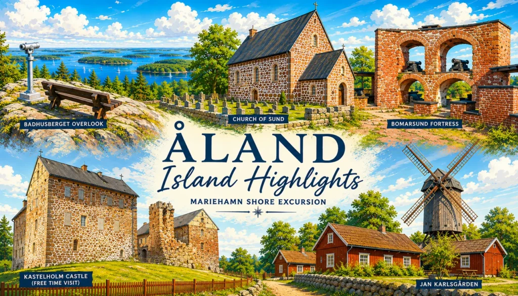
✘ Mariehamn, Åland Islands, Finland • June 21, 2026
⌖ Across Åland from Mariehamn to Jan Karlsgården
Tour Route: Mariehamn → Järsö Islands → Mariehamn Water Tower Overlook → Church of Sund → Bomarsund Fortress → Jan Karlsgården → Kastelholm Castle → Mariehamn
We left the port area in a small van operated by Sunds Buss & Lastbilstransporter, beginning with a drive through Mariehamn before turning south toward the Järsö Islands.
The change from town to countryside came quickly. Mariehamn’s residential streets gave way to wooded roads, low shoreline landscapes, and traditional houses set among the trees. The route continued across a succession of narrow causeways and bridges, with water appearing repeatedly on either side of the road.
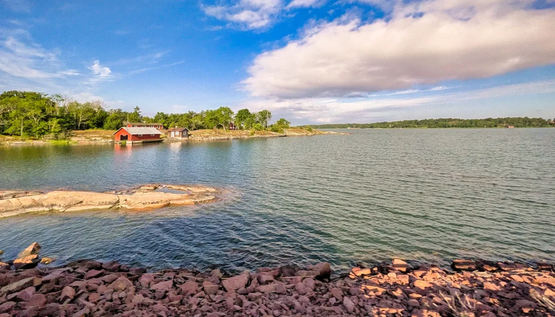
Rocky shoreline, wooded islands, and a traditional red boathouse line the waters south of Mariehamn as the tour follows the island road toward Järsö.
Järsö lies immediately south of Mariehamn and is reached along one of Åland’s characteristic island roads, crossing bridges and embankments between small islands. Rather than stopping at a formal attraction, this portion of the excursion functioned primarily as a scenic introduction to the archipelago.
The large windows of the van provided open views across the surrounding landscape as we continued toward the end of the road before turning back toward Mariehamn.
① Mariehamn Water Tower Overlook
⚲ Badhusberget, Mariehamn, Åland Islands
⧗ ~15 minutes
Our first stop came on Badhusberget, a rocky hill rising above Mariehamn beside the city’s water tower. The tower itself was not part of the visit; the stop was made for the elevated views from the surrounding hillside.
Once out of the van, the group spread naturally across the broad exposed rock. Some people found a place to sit and take in the scenery, while others stood or moved around the hillside taking photographs. The open granite surface formed part of the setting itself, with trees dropping away toward the water below.
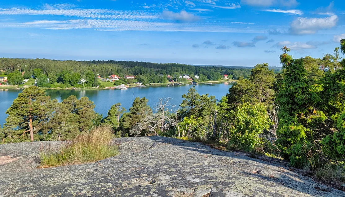
Exposed granite gives way to wooded shoreline and sheltered water below Badhusberget, illustrating the island-and-water geography that surrounds Mariehamn.
From here, the guide directed our attention westward across the water toward Sweden on the opposite side of the Sea of Åland. Below us were sheltered waterways, wooded shorelines, waterfront homes, small docks, and sailboats, with Mariehamn’s Western Harbour farther beyond. She also pointed out the masts of the museum ship Pommern and the area where our ship was docked.
The elevated position provided a useful sense of Åland’s geography: water, wooded islands, and narrow shorelines extending outward from Mariehamn rather than a conventional city panorama.
After about fifteen minutes of looking across the landscape, and taking photographs, we returned to the vehicle and continued toward Sund.
② Church of Sund
⚲ Sund Church, Sund, Åland Islands
⧗ ~30 minutes
Continuing through the countryside of Sund, we began seeing midsommarstänger, the tall Midsummer poles erected by communities throughout the islands and decorated with greenery and traditional ornaments. They are among the most recognizable symbols of Åland’s Midsummer celebrations, and their appearance along the route reflected the timing of our visit during one of the most important holidays of the year.
We soon reached the Church of Sund, one of Åland’s oldest and most important medieval stone churches.
The church dates to approximately 1250-1275, making the building itself roughly three-quarters of a millennium old. Constructed largely from the reddish local granite characteristic of Åland, its thick stone walls and relatively simple exterior give little indication of some of the remarkable medieval features preserved inside.
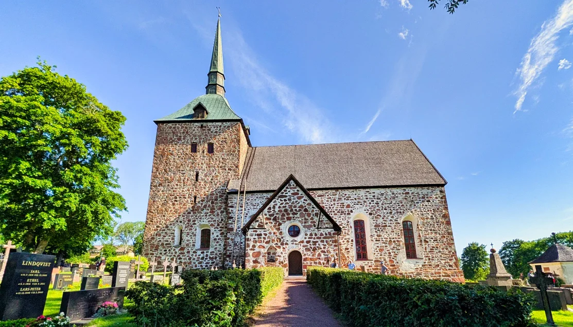
The medieval Church of Sund rises above its surrounding churchyard, its reddish local granite walls dating to the thirteenth century.
The planned visit normally includes the church interior, where early Gothic wall paintings survive along with an extraordinary 5.06-meter triumphal crucifix dating to the 1250s. Near the entrance is another rarity: a votive painting from 1671, the only surviving example of its kind in Åland and one of the features specifically highlighted in our excursion description.
Unfortunately, our visit coincided with the Midsummer holiday period, and the church was closed. Missing the interior therefore meant considerably more than simply missing a look inside an old church. Some of the most historically significant features of the stop were behind those locked doors.
Instead, we spent about thirty minutes exploring the exterior and walking through the surrounding churchyard.
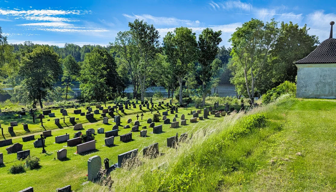
Gravestones spread down the grassy hillside toward the wooded shoreline, placing the medieval church within Åland’s quiet rural landscape.
During our walk through the cemetery, our guide focused our attention on the grave of Joh. Nordin (1813-1888). His stone describes him with the Swedish words “Bonden och Sjöfararen,” meaning “the farmer and seafarer.” His wife, Anna Elisab. (1822-1904), is commemorated beneath him.
That short inscription offered an unexpectedly revealing glimpse into nineteenth-century life in Åland. Farming and seafaring were closely intertwined across the islands, where agricultural families also participated in the maritime economy. Nordin’s gravestone preserves both identities in the few words chosen to describe his life: farmer and seafarer.
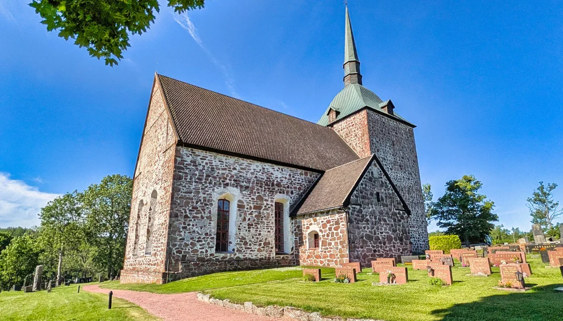
A closer exterior view reveals the church’s massive granite walls, steep roof, and square tower, architectural features preserved through roughly 750 years of history.
We continued around the churchyard, examining the medieval church. Its rough granite walls, small window openings, old gravestones, and quiet rural setting gave the stop a character quite different from the residential and maritime landscapes we had encountered earlier.
③ Bomarsund Fortress
⚲ Bomarsund Fortress Area, Sund, Åland Islands
⧗ ~30 minutes
Leaving the Church of Sund, we moved forward several centuries to Bomarsund Fortress, the remains of an enormous Russian military complex whose ruins now spread across the surrounding hills and shoreline.
Åland had become part of the Russian Empire in 1809, when Sweden lost Finland and the islands to Russia. That placed Åland at the western edge of the empire, in a strategically important position in the Baltic Sea. Construction at Bomarsund began in the 1830s, with plans for a massive central fortress protected by 12 separate defensive towers positioned around it.
The ambition was considerably greater than what Russia managed to complete. By 1854, the main fortress and only three of the planned 12 towers had been finished.
That was the year the Crimean War reached Åland.
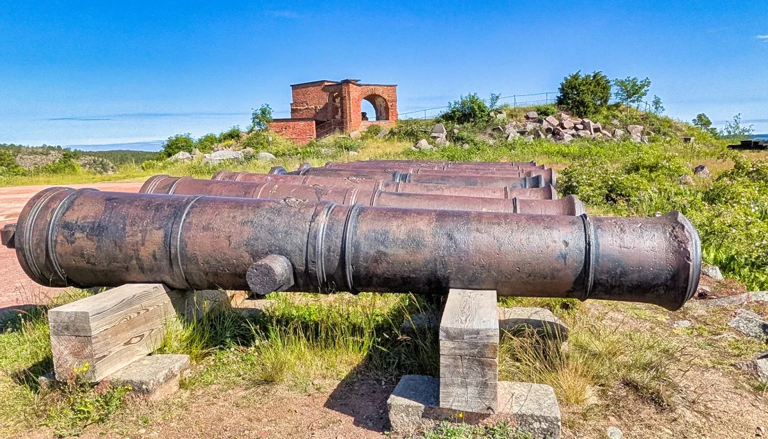
Surviving cannons stand before the ruins of Bomarsund, the massive Russian fortress complex attacked by British and French forces during the Crimean War in 1854.
British and French forces attacked Bomarsund in August 1854. As our guide explained, the Russians had prepared their defenses expecting an attack from the north, but the allied forces approached from the less-protected south. Troops landed on Åland, and artillery batteries were established on the surrounding high ground.
Bomarsund’s massive granite construction could withstand considerable punishment, but the battle exposed another weakness. Cannon fire inside the defensive towers generated intense heat and smoke, making conditions increasingly difficult for the soldiers operating within the enclosed positions. The outlying towers were overcome, the Russian garrison eventually surrendered, and the victorious forces destroyed the fortress rather than leave it available for future Russian use.
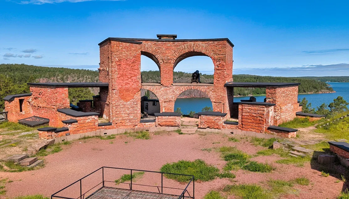
The surviving brickwork and cannon positions show how the fortress defenses were arranged around openings overlooking the surrounding landscape.
Our visit concentrated on one of the surviving tower ruins.
We left the van and walked up through the remains, where the surviving granite and brickwork allowed us to move inside portions of the former defensive structure. An interpretive display showed how the tower had originally been arranged, with a circular plan, central courtyard, rooms around the interior, and cannon positions facing outward.
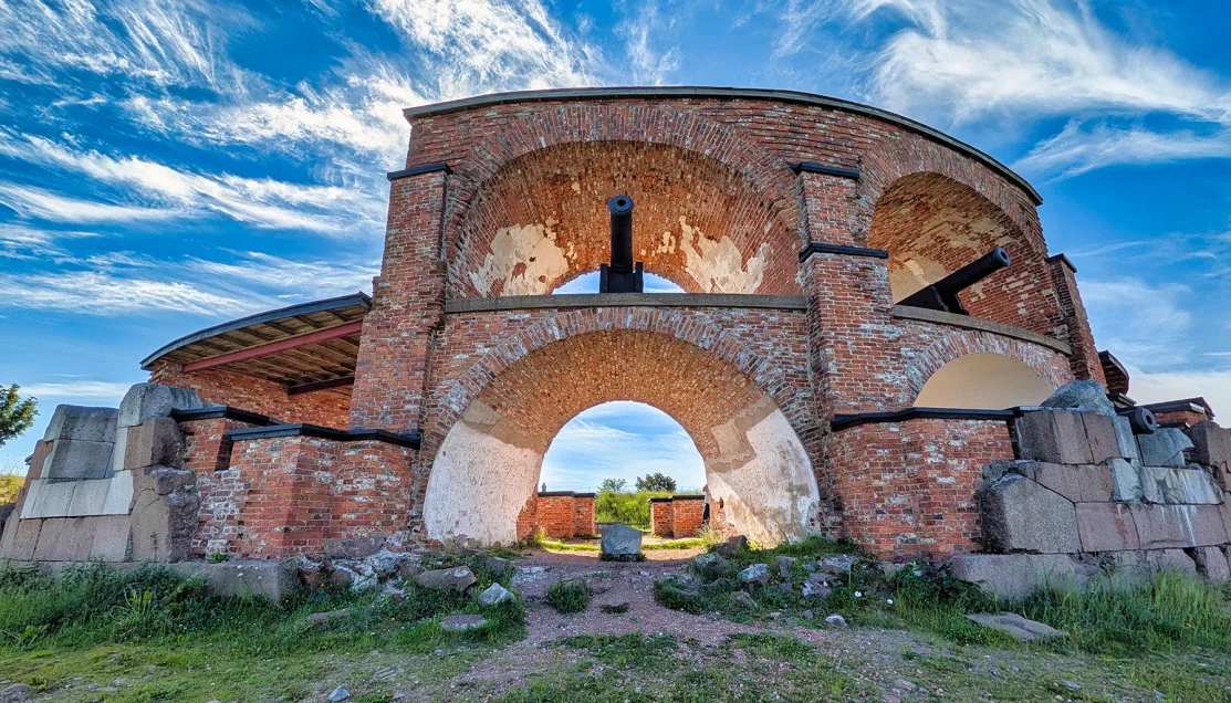
Brick arches and surviving cannon positions reveal the interior structure of one of Bomarsund’s defensive ruins, where artillery once faced the surrounding approaches.
Seeing that plan while standing within the ruins made the surviving walls much easier to understand. What initially appeared to be disconnected sections of masonry had once formed part of a carefully organized military structure built to control the surrounding approaches.
We continued through the tower, eventually reaching the level where the defensive position opened toward the surrounding landscape and water. From there, we could look outward across the same terrain the fortress had been constructed to defend.
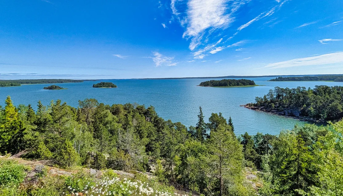
From the high ground surrounding the fortress, the view across Åland’s islands and waterways reveals the strategic Baltic landscape Bomarsund was built to defend.
After about thirty minutes of walking through the ruins, listening to the guide’s explanation, and photographing the surviving tower and surrounding landscape, we returned to the van and continued toward Kastelholm.
④ Jan Karlsgården Open-Air Museum
⚲ Jan Karlsgården Open-Air Museum, Kastelholm, Sund, Åland Islands
⧗ ~50 minutes including free time
Our final scheduled stop was Jan Karlsgården Open-Air Museum, a recreation of an Åland farmstead from the latter half of the 1800s. Approximately 20 historic buildings from different parts of the islands have been brought together here to create a museum.
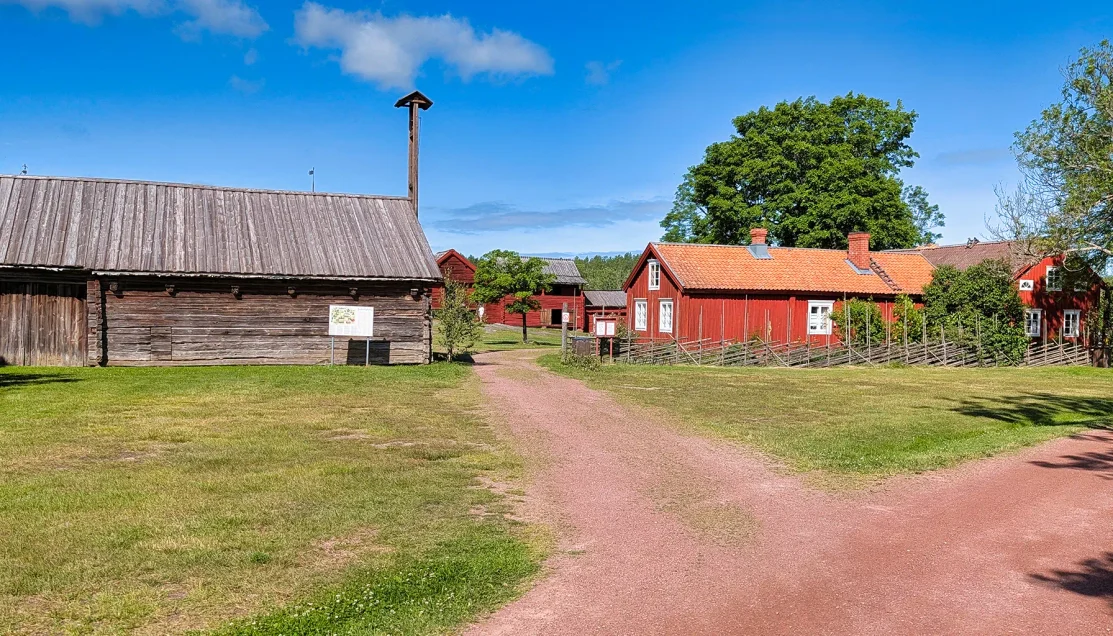
Historic homes, barns, fences, and farm buildings are arranged across the grounds to recreate an Åland farmstead from the latter half of the 1800s.
However, rather than concentrating on a single historic house, Jan Karlsgården preserves an entire rural environment. Residential buildings stand among barns and specialized working structures, including a cow shed, ox stable, smithy, smoke sauna, storage buildings, and windmill. Together they show how domestic life and the daily work of a traditional Åland farm were divided among separate structures.
We began with our guide, walking among the buildings and through the central farmyard. Some structures retained their exposed log construction, while others were finished in the deep red commonly associated with Scandinavian farm buildings. Fences and unpaved paths separated the different parts of the farmstead, giving the museum the appearance of a small rural settlement rather than a collection of buildings arranged for display.
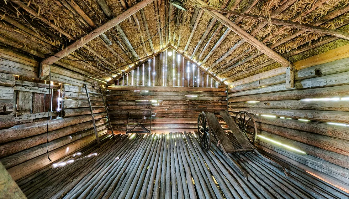
Rough log walls, pole flooring, exposed roof framing, and a wooden farm cart reveal the practical construction of one of the farmstead’s working buildings.
Inside, the character changed from agricultural work to domestic life. Period rooms contained box beds, tables, chairs, textiles, household objects, and other furnishings showing how families lived within the farmstead. Some interiors were quite simple, while others included decorative details such as painted wall panels and patterned wall coverings.
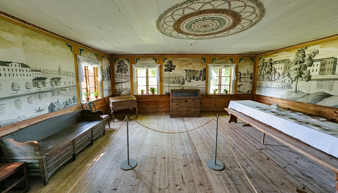
Painted landscape panels, decorative ceiling work, and period furnishings show the more finished domestic side of life within the historic farmstead.
Agricultural buildings contained carts, tools, and equipment on rough wooden or earthen floors. Outside, a traditional windmill rose above the surrounding roofs, while smaller raised storage buildings and specialized outbuildings demonstrated how many separate structures were once required to operate a working farm.
Jan Karlsgården also remains closely connected with Åland’s Midsummer traditions. A midsommarstång stands prominently on the museum grounds, and the farmstead is one of the places where the traditional pole is raised as part of the annual Midsummer celebration.
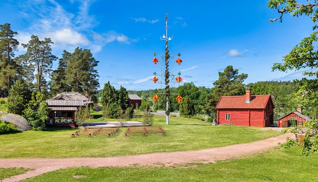
A traditional midsommarstång decorated with colorful crowns stands prominently on the museum grounds, reflecting Åland’s distinctive Midsummer traditions.
After the guided portion, we were given free time to explore the museum independently.
Immediately beyond the museum grounds stood Kastelholm Castle. The castle was not included as an official stop on our Island Highlights excursion, but it was close enough to make an independent visit possible during the free-time period. Doing so, however, required a deliberate tradeoff. The available time was short, so anyone wanting to see the castle needed to move quickly, keep careful track of the group’s departure time, or leave the guided portion at Jan Karlsgården early to allow more time for the castle.
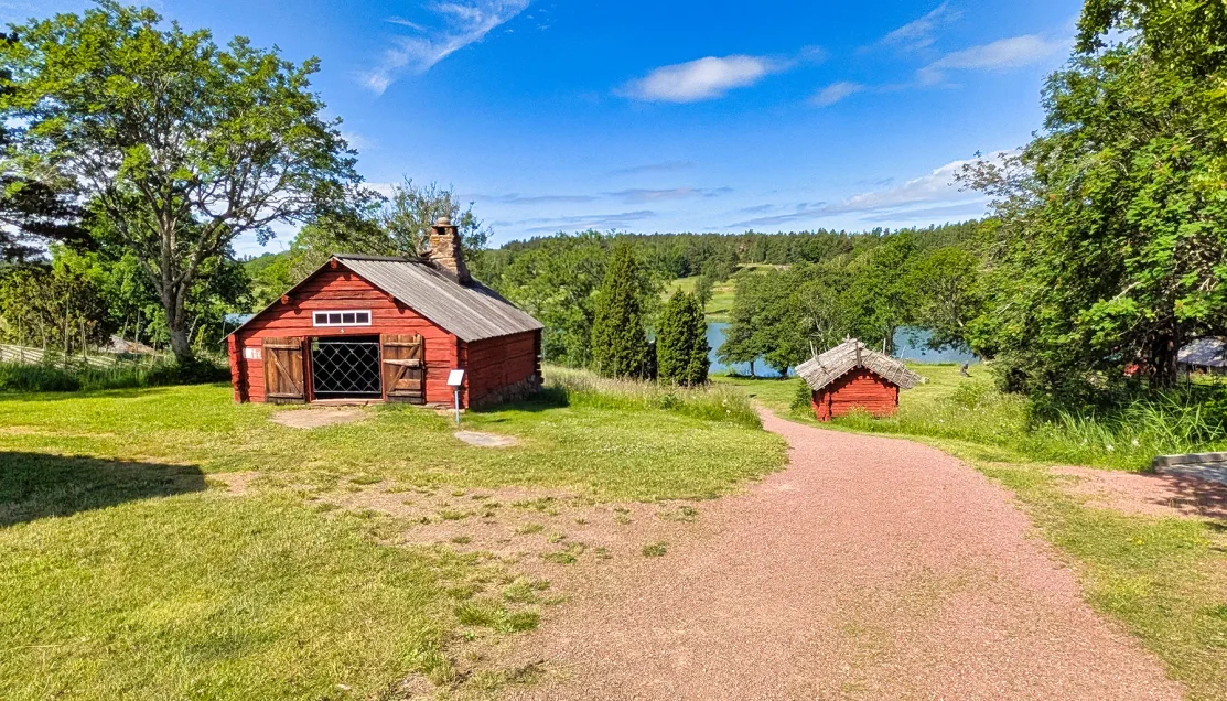
Gravel paths, grassy slopes, and buildings spaced across the grounds show the terrain and open layout visitors encounter while exploring the museum.
We chose to use our free time to briefly experience the castle.
⑤ Kastelholm Castle — Independent Visit
⚲ Kastelholm Castle, Kastelholm, Sund, Åland Islands
⧗ ~20 minutes during Jan Karlsgården free time
Kastelholm Castle is Åland’s only medieval castle and one of the islands’ most important historic sites.
Founded as a defensive fortress in the late 1300s, Kastelholm occupied a strategic position along the waterways connecting Sweden with its territories to the east. The castle was expanded repeatedly over the following centuries, eventually developing from a military stronghold into an important center of administration. Swedish kings and other powerful figures passed through Kastelholm, including Gustav Vasa, who spent time here during the 1500s.
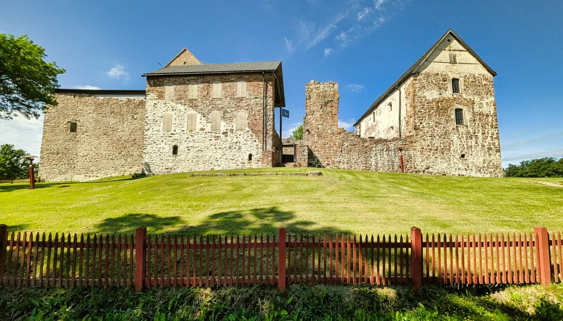
The surviving medieval complex rises above the lawn at Kastelholm, its towers, stone walls, and partially ruined sections revealing the castle’s expansion over several centuries.
By the late 1600s, the castle had lost much of its importance and was eventually abandoned. Centuries of deterioration followed before restoration work preserved the substantial structure that survives today.
⌖ Inside Kastelholm
Once inside, Kastelholm proved surprisingly substantial for a castle we were fitting into such a short visit.
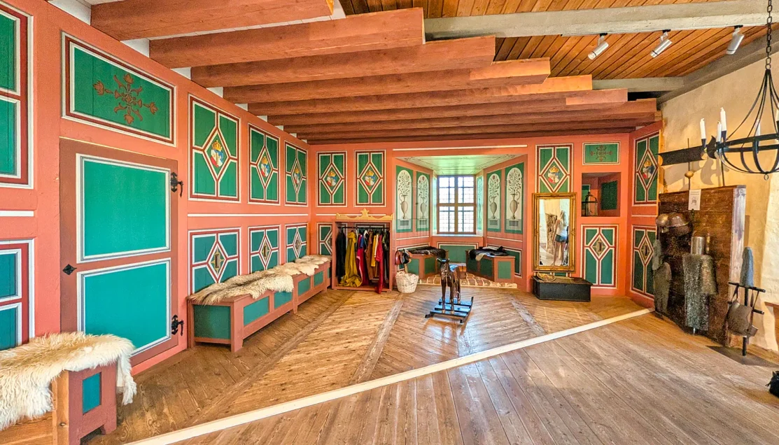
Painted wall panels, timber beams, wooden furnishings, and period displays recreate the more comfortable side of life within the fortress.
The route climbed through the surviving structure using stairways and elevated walkways, passing between restored rooms and sections where the castle had been left much closer to its ruined state.
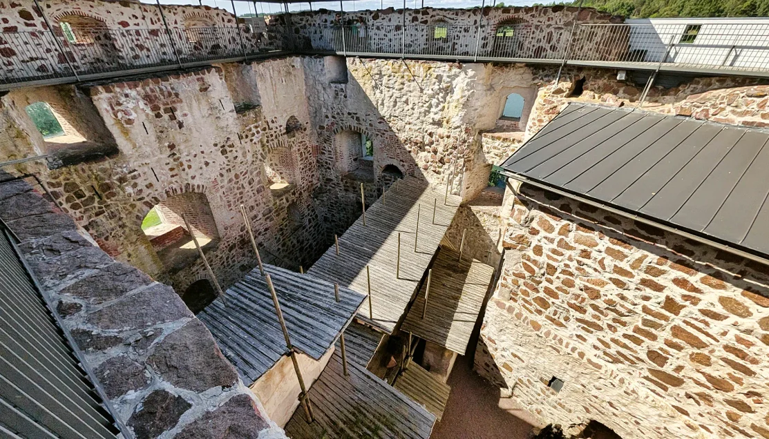
Elevated walkways cross the roofless interior, revealing surviving masonry, former floor levels, and spaces once hidden within the castle.
That contrast was one of the most interesting parts of the visit. In one room we were walking across finished wooden floors beneath heavy timber beams; a few moments later we were looking down into the exposed interior of the castle, where missing floors revealed foundations, earlier masonry, and a circular stone-lined opening below.
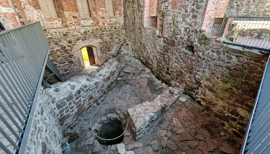
Missing floors expose foundations, layers of stone and brick construction, and a circular stone-lined opening within the castle’s lower structure.
Those open sections were particularly striking because they made it possible to see the castle almost in cross-section. Granite from the medieval structure remained alongside later brick construction, with doorways and window openings suspended at levels that once connected rooms and floors that no longer exist. Modern walkways now pass through the empty spaces, allowing visitors to look directly into portions of the building that would normally be hidden beneath a restored floor.
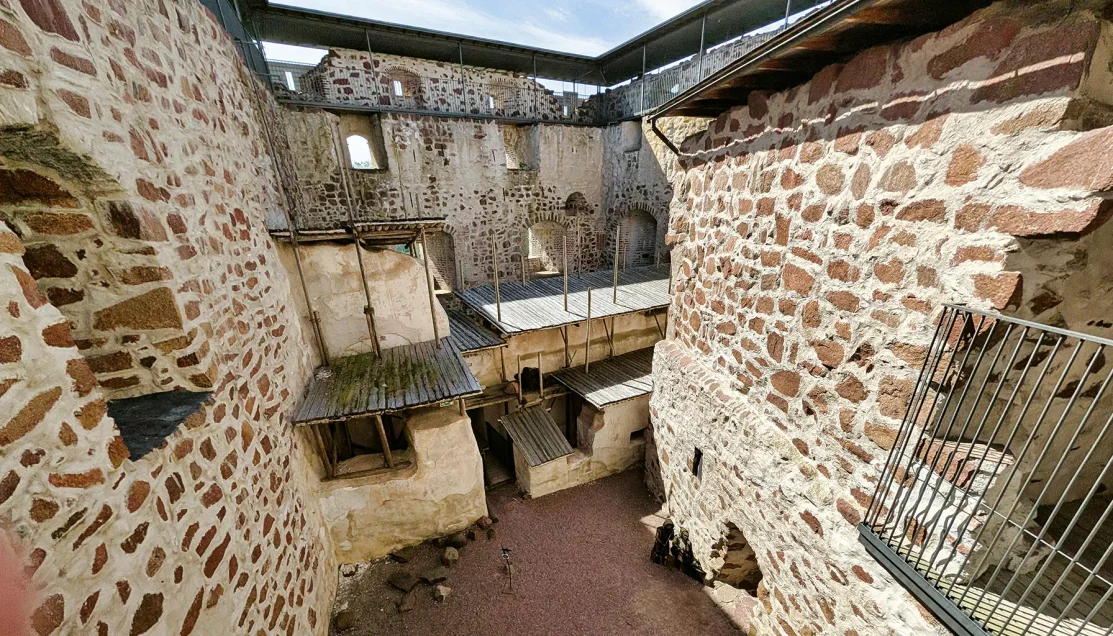
Modern walkways thread through exposed stone walls and missing floors, allowing visitors to move directly through the castle’s surviving structure.
As we continued upward, the castle became more interpretive. Heraldic shields and displays introduced some of the rulers and nobles associated with Kastelholm, while several reconstructed rooms gave a sense of the more comfortable side of castle life. Painted walls, wooden furniture, textiles, and other furnishings were a sharp change from the exposed stonework we had just walked through.
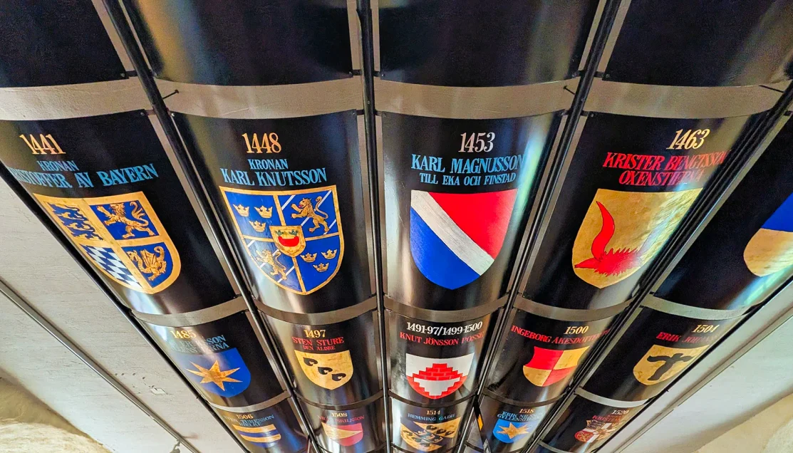
Heraldic shields identify rulers and nobles associated with the castle, adding historical context as the route continues through the upper levels.
It was worth continuing to the upper levels. Windows and defensive openings looked outward across the surrounding water, fields, and woodland, bringing the castle’s strategic location into focus. Kastelholm was not simply an impressive residence placed in the countryside. From here, movement through the surrounding waterways could be watched and controlled.
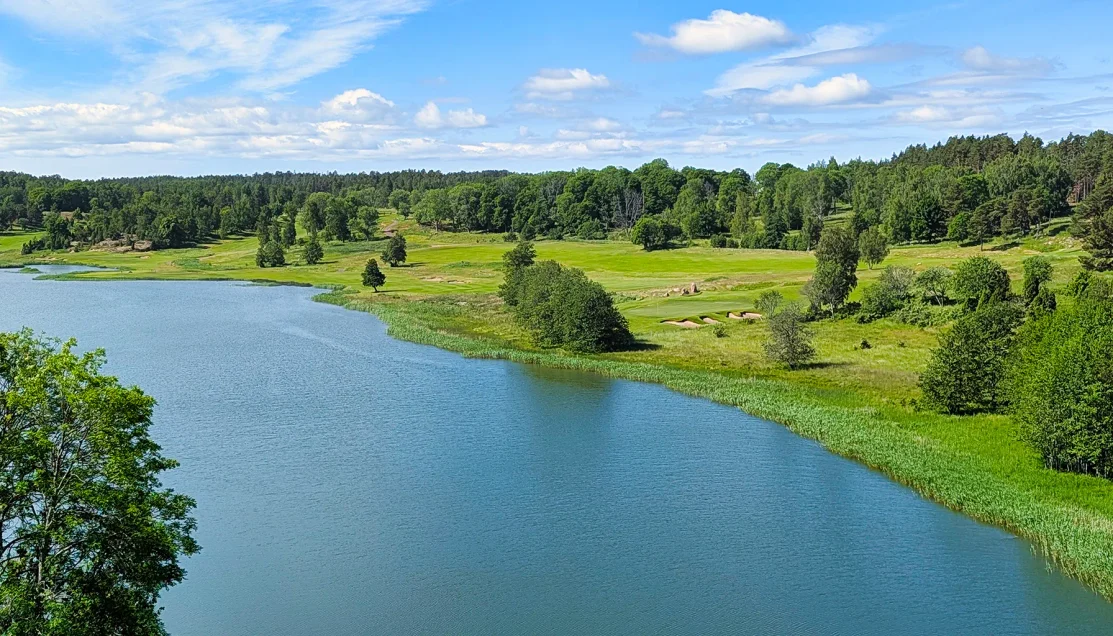
Water, fields, and woodland spread beyond the castle, illustrating the strategic landscape that surrounded the medieval stronghold.
With only about twenty minutes, there was no opportunity to stop and study every display. The experience was really about moving through the castle itself: climbing through its different levels, seeing how the medieval stonework and later additions fit together, looking down into the exposed ruins, and reaching the upper portions where the surrounding landscape becomes part of the story.
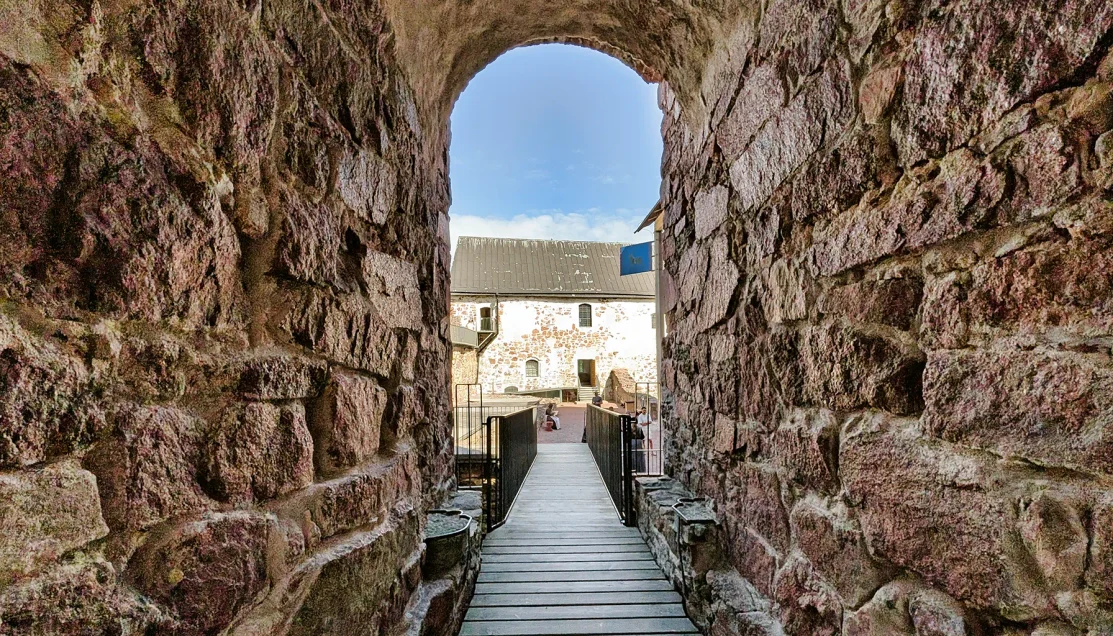
A n archway passes through a thick stone opening, connecting surviving sections of the medieval fortress.
For such a short visit, we saw considerably more than we expected.
Given its location immediately beside Jan Karlsgården, Kastelholm Castle makes a natural addition to this itinerary presenting two very different sides of Åland’s history.
Return to Mariehamn
With everyone back aboard the van, we left Jan Karlsgården Open-Air Museum and began the return drive toward Mariehamn.
The route carried us back through the wooded interior of Åland before residential development gradually increased approaching the capital.
The four-hour format covered several distinct parts of Åland in a compact morning, moving from island scenery and medieval religious architecture to Russian military ruins and traditional rural life before returning to the port.
☑ Who Is This Tour Best For?
- History-focused travelers – Visitors interested in Åland’s layered history, from its medieval churches and Kastelholm Castle to the remains of the 19th-century Russian fortress at Bomarsund.
- Travelers who prefer smaller groups – The Oceania Exclusive format limits the excursion to 16 guests, making it easier to move between the island’s relatively small historic sites without the feel of a full-size coach group.
- Scenery and culture travelers – The route combines historic sites with Åland’s rural landscape, traditional architecture, Midsummer traditions, and the preserved farm environment at Jan Karlsgården.
- Independent explorers – Free time at Jan Karlsgården provides an opportunity to visit neighboring Kastelholm Castle independently, although doing so requires moving quickly and keeping careful track of the departure time + entry fee.
⊞ Tour Summary
- Tour Name: OE – Island Highlights (Small Group)
- Port: Mariehamn, Åland Islands, Finland
- Ship: Oceania Insignia
- Total Duration: ~4 hours
- Primary Focus: Åland history, rural culture, and island scenery
- Main Stops: Mariehamn Water Tower viewpoint, Church of Sund, Bomarsund Fortress, Jan Karlsgården Open-Air Museum
- Independent Addition: Kastelholm Castle during free time at Jan Karlsgården
- Meal Included: No
▣ Activity Summary
- Walking Distance: Light to moderate, spread across several relatively short stops
- Terrain: Exposed bedrock at the scenic viewpoint; churchyard paths; uneven historic surfaces at Bomarsund; gravel, grass, and unpaved paths at Jan Karlsgården; stairs and elevated walkways inside Kastelholm Castle
- Accessibility: Most scheduled stops require relatively short walks, although uneven surfaces and exposed rock may be challenging for guests with limited mobility
- Pacing: Relaxed at the scheduled stops, with approximately 50 minutes at Jan Karlsgården including free time
- Group Size: Small group, limited to 16 guests
- Restrooms: Available at select stops
- Meal Included: No
- Independent Castle Visit: Possible during Jan Karlsgården free time, but requires moving quickly and carefully managing the available time

Related Northern Europe Travel: Explore more Northern European cruise ports and shore excursions in our complete regional guide.
→ Northern Europe Cruises & Shore Excursions Guide
© OceansAfoot