✘ Gran Canaria, Canary Islands • December 26, 2025
⌖ Laurel Forests, Ravines, and Water Landscapes of Northern Gran Canaria
Tour Route: Las Palmas → Los Tilos de Moya (Doramas Natural Park) → Firgas → Las Palmas
After gathering at the pier, our small group boarded a minibus-style coach and departed the port in late morning, leaving the coastal zone behind and beginning a steady climb into the island’s interior. The drive north took roughly forty minutes, moving quickly from urban streets into a landscape shaped by deep ravines, terraced hillsides, and sharp elevation changes.
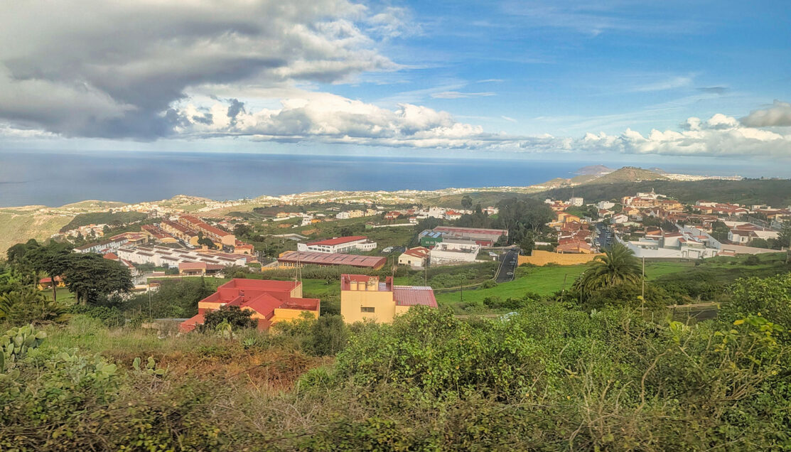
As the route crossed onto the northern side of Gran Canaria, the environment changed noticeably. Moist air carried inland by the northeast trade winds thickened into low clouds, and vegetation became progressively greener with every kilometer. Farmland clung to steep slopes, narrow roads traced the contours of ravines, and the island’s volcanic structure became more apparent from above.
By the time the vehicle reached the trailhead near Los Tilos de Moya, light rain and mist were already present—early signs of the cooler, wetter microclimate that supports one of Gran Canaria’s last remaining laurel forest valleys.
① Los Tilos de Moya (Doramas Natural Park)
⚲ Los Tilos de Moya, Doramas Natural Park, Moya–Firgas area, Gran Canaria, Canary Islands
⧗ ~1 hour, 15 minutes
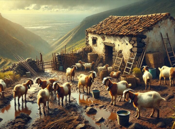
Our hike began at Los Tilos de Moya, a protected valley between Moya and Firgas within Doramas Natural Park. This reserve preserves one of the most ecologically significant remnants of native forest on Gran Canaria.
Upon arrival, conditions were cool, damp, and overcast, following several days of rainfall. The visit began with a short briefing at the trailhead map, where the guide explained route options and current conditions. Due to saturated ground and recent weather damage, access to the lower ravine loop was closed, and the walk followed a shorter out-and-back route along the upper section of the valley.
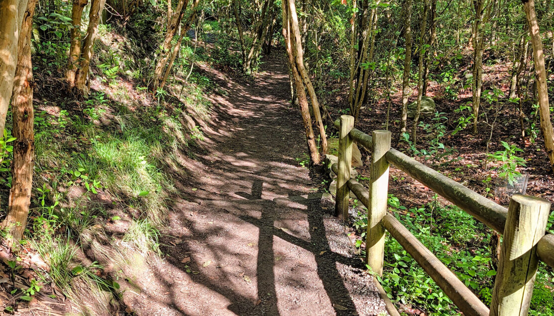
A maintained dirt path winds through the laurel forest, showing how access here is carefully managed rather than left wild.
The trail surface alternated between packed dirt, gravel, and embedded stone, with shallow steps and gentle elevation changes rather than a sustained descent. Wooden rail fencing and occasional paved stretches marked areas where the path runs close to the access road, reinforcing that this was a managed natural reserve rather than a remote wilderness trail.
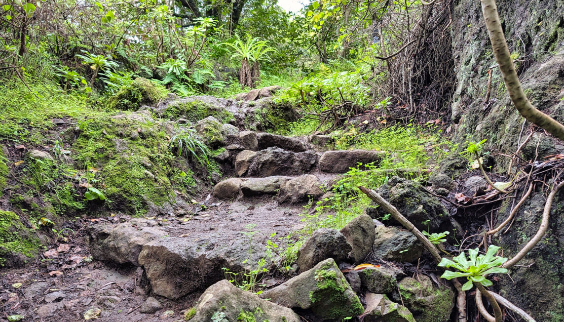
Embedded stone steps stabilize a naturally eroding ravine, reflecting long-term efforts to control water damage in a fragile valley.
Even within this upper section, the vegetation was notably dense. Moisture collected throughout the valley feeds a network of open stone water channels, with visible flow moving steadily downhill—small waterways that support the surrounding plant life and show how water has long been intentionally directed through the landscape.
Los Tilos is especially valued for its concentration of endemic plant species, including remnants of laurel forest (laurisilva)—a prehistoric forest type that once covered much of southern Europe and today survives primarily in parts of Macaronesia. Rather than relying solely on rainfall, this forest captures moisture directly from low clouds and mist carried inland by trade winds, a process made visible as water clung to leaves and dripped steadily from its canopy.
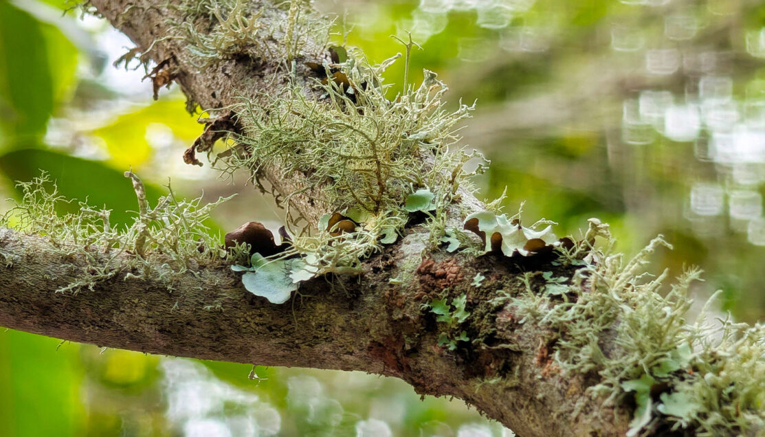
Lichen growing directly on laurel branches thrives on constant mist, making it a living indicator of cloud-fed moisture rather than rainfall alone.
At the turnaround point, the guide paused for a detailed explanation of the valley’s hydrology and its broader importance to the island. The discussion focused on how rainfall and groundwater are captured within Gran Canaria’s volcanic interior, how water rights developed historically, and why access to fresh water remains uneven across the island. While high-quality spring water is diverted for agriculture and industry, many communities depend primarily on desalinated water, tying protected valleys like Los Tilos directly to ongoing environmental and political debates.
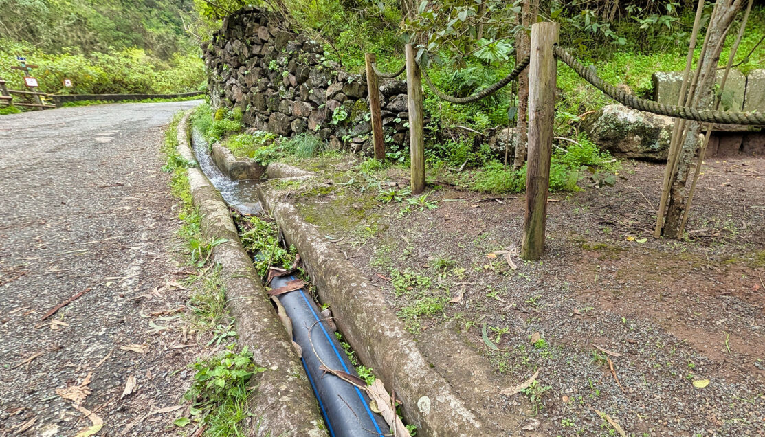
Rainwater collected from the forest is diverted into stone channels and modern piping, prioritizing downstream extraction over local access.
As conditions remained damp, the group retraced its steps along the same route. The return walk continued to highlight erosion control, reforestation efforts, and long-term water management strategies within the park.
Leaving Los Tilos de Moya, we rejoined the van and headed downhill toward Firgas, passing steep cliff faces and deeply incised ravines as the route descended toward the town often referred to as the Village of Water.
② Firgas (The Village of Water)
⚲ Firgas, Gran Canaria, Canary Islands
⧗ ~30 minutes
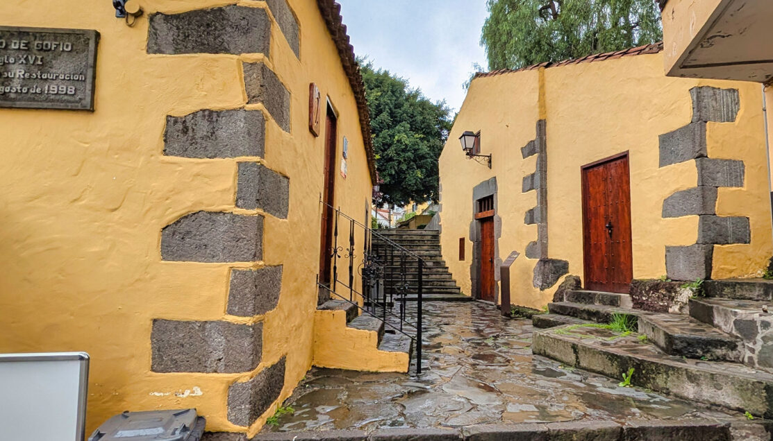
Once in Firgas, we continued on foot through the town center. Rain fell on and off throughout the visit, leaving the stone streets slick and requiring careful footing, but the town’s compact layout made it well suited to a brief walking exploration.
One of our first stops was the Molino de Firgas, a historic gofio mill built around water power. Although the interior was closed, the exterior alone made its function easy to understand. Elevated stone channels showed how water was once directed to turn milling equipment used to produce gofio, a toasted grain flour that remains a staple of Canarian cuisine. It served as a practical, everyday example of how water shaped daily life in the town.
The Molino de Firgas used diverted water to power grain milling, linking agricultural production directly to controlled flow systems.
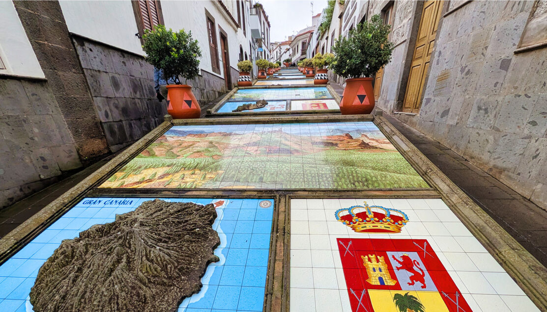
From there, we climbed uphill through Firgas’s most recognizable feature: a series of ornamental water cascades and ceramic installations built directly into the street. Water flowed continuously down stepped channels, passing tile murals that depict each of the Canary Islands with names, elevations, and symbolic imagery. With rainwater feeding into the channels, the displays felt less decorative and more explanatory—almost like a physical map of the archipelago unfolding beneath our feet.
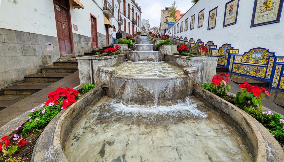
Firgas’s central cascades visually trace the islands of the archipelago, turning water into a geographic and cultural display.
We paused at Plaza de San Roque, gathering just outside Iglesia de San Roque, where the guide used the setting to explain one of the most important systems shaping life in this part of Gran Canaria: the Acequia Real de la Heredad de Aguas de Arucas y Firgas.
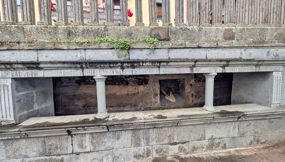
Open stonework reveals where the Acequia Real once carried measured water through town before continuing underground.
Standing beside the stone channels and wash structures near the church, he pointed out how this historic watercourse—dating back centuries—once ran openly through Firgas before continuing underground beneath the town. Using the visible stonework as a reference, he explained how water was measured, divided, and distributed to surrounding agricultural areas, and why Firgas developed where it did. It was a practical, visual explanation that tied directly back to the laurel forests and ravines we had just walked through.
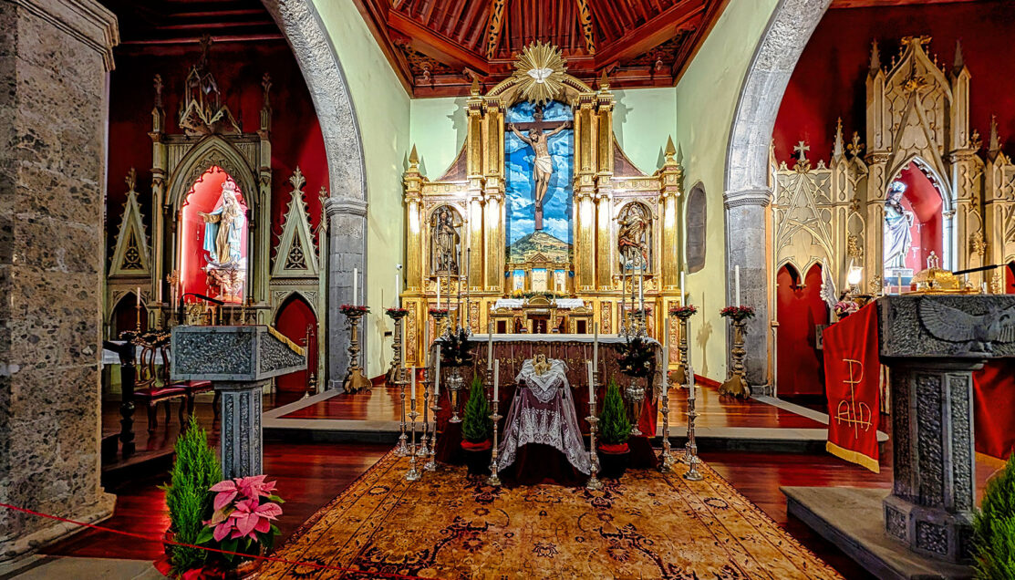
The richly decorated altar anchors the church as both a spiritual and civic center within Firgas’s historic core.
Afterward, we stepped inside the church itself, grateful for a brief break from the damp weather. The interior was calm and warmly lit, with dark stone arches, a wooden ceiling, and a richly decorated altar. Seasonal Christmas displays—including a detailed nativity scene—reflected the holiday period and added a distinctly local touch to the visit.
The tiled stairway in Firgas maps the Canary Islands in sequence, turning a steep street into a walkable representation of the archipelago.
We concluded the walk with a final pass along the tiled water features, reinforcing the contrast established earlier in the day: water captured naturally in protected ravines, then carefully controlled, measured, and displayed once it reaches town. With rain still falling steadily, we made the short walk toward the restaurant, transitioning from exploration to lunch.
③ Lunch in Firgas (El Rincón de Marcos)
⚲ El Rincón de Marcos, Firgas, Gran Canaria, Canary Islands
⧗ ~1 hour, 15 minutes
Lunch was served at El Rincón de Marcos, a small, casual bar-restaurant tucked along one of Firgas’s side streets. After the rain-soaked walk through town, sitting down indoors felt like a welcome reset and a natural midpoint in the day.
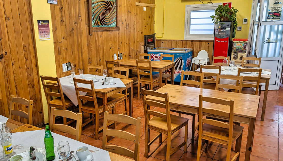
Simple wooden tables and a straightforward layout define the dining room at El Rincón de Marcos.
The menu leaned heavily toward traditional Canarian dishes, with a noticeable emphasis on watercress, a staple ingredient in northern Gran Canaria where consistent moisture allows it to thrive. Local drinks were available, including Dorada Especial, which several of us ordered as the tables filled and jackets were finally shed.
Fresh vegetables and local cheese reflect a cuisine shaped more by availability than presentation.
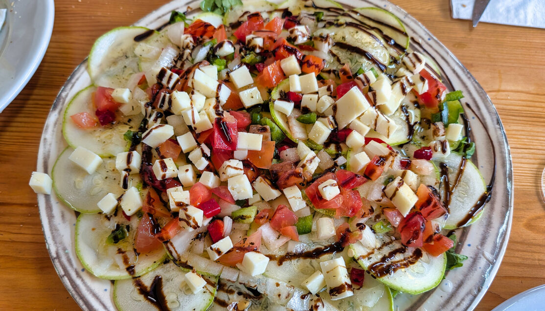
The meal began with shared starters: fresh bread, local cheese, and simple vegetable plates, followed by papas—small local potatoes served in classic Canarian style with mojo.
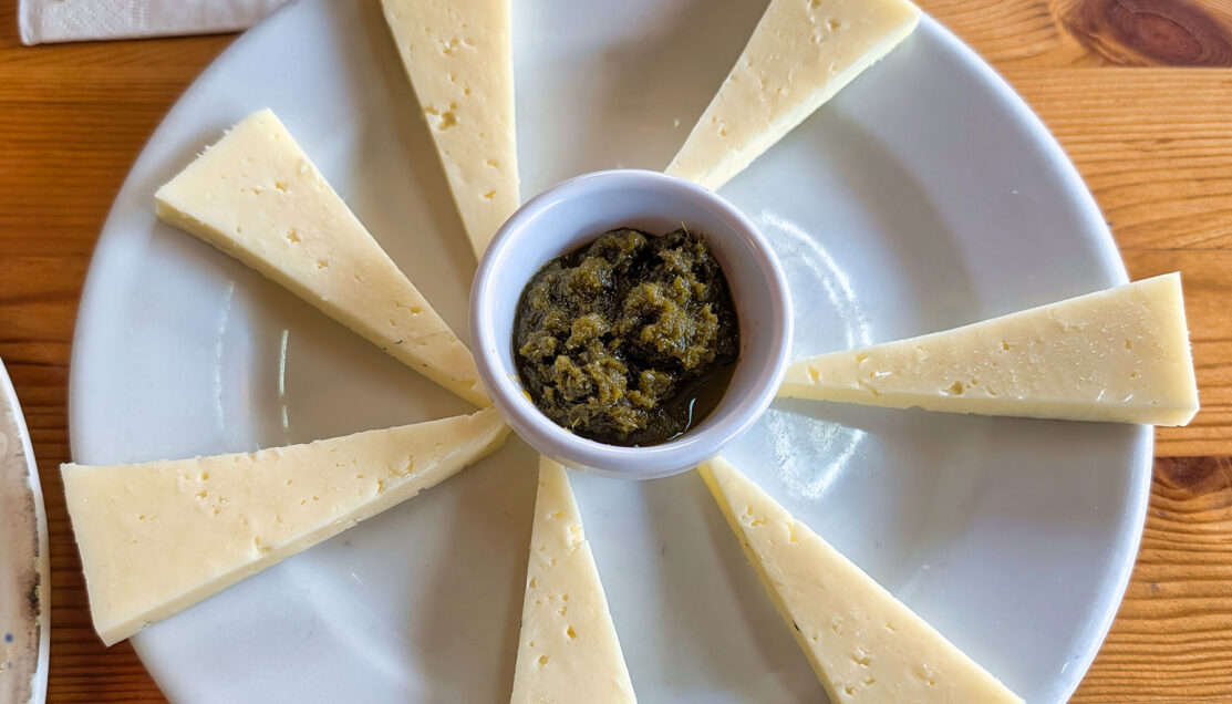
Fresh, lightly aged island cheese served with mojo verde—traditionally made with herbs and watercress—showing how even simple starters reflect Gran Canaria’s reliance on moisture-rich greens and local dairy.
Several of the accompanying dishes incorporated watercress in different forms, reinforcing the theme we had encountered throughout the morning. These included croquettes made with either fish or watercress, along with sauces where watercress was blended into familiar preparations such as alioli.
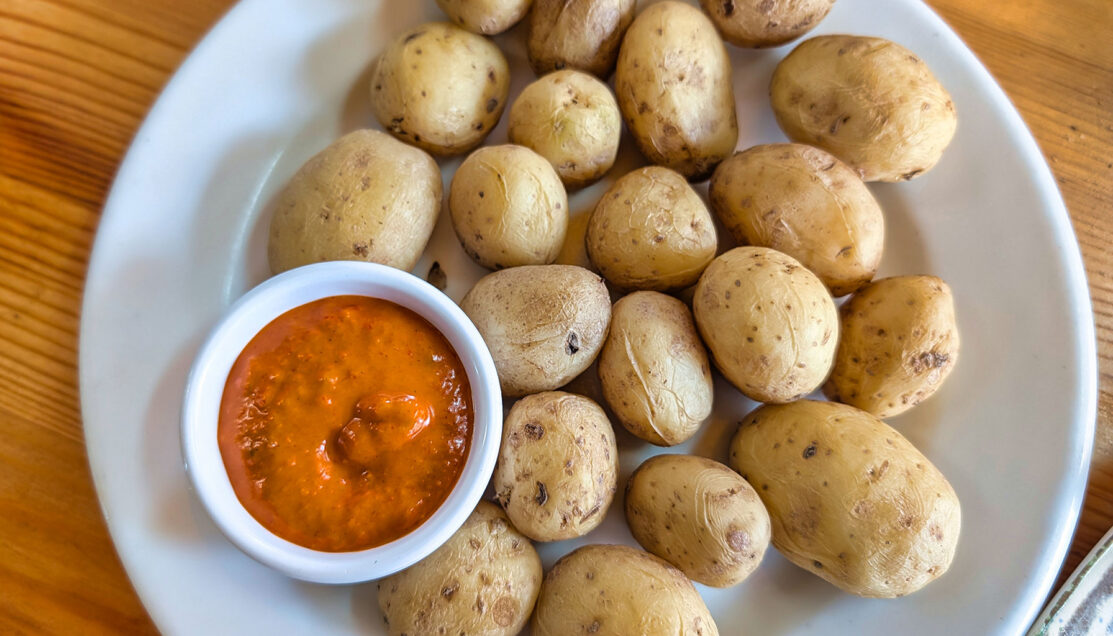
Small Canarian potatoes are served plainly, with mojo providing the primary contrast of heat and acidity.
The food was straightforward and unfussy, relying on local ingredients rather than elaborate presentation. As we ate, the guide continued tying the meal back to the landscape, explaining how ingredients like potatoes, greens, and cheese reflect the island’s climate, water availability, and long-standing agricultural traditions.
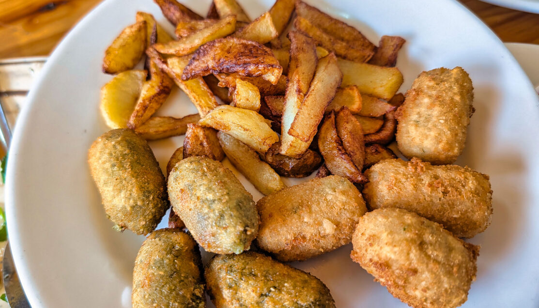
Both fish and watercress croquettes translate regional ingredients into everyday bar food.
Dessert followed the same local approach, with a choice between custard or ice cream, including a watercress-based option for those curious to try a distinctly regional variation.
After a relaxed lunch, we regrouped outside the restaurant and boarded the van for the return drive toward the coast. The road descended steadily through green hills and scattered villages, gradually opening up to broad views of the Atlantic below.
The descent back toward the Atlantic reveals how quickly forested interior landscapes give way to the coast.
It brought the day full circle—from cloud-fed forests and carefully managed waterways to a meal shaped by the same systems—before returning us to the port with time to spare.
☑ Who Is This Tour Best For?
- Nature-focused travelers — those interested in cloud forests, ravines, and the ecological systems that sustain life on Gran Canaria.
- Cultural landscape explorers — visitors who enjoy understanding how towns, agriculture, and infrastructure evolved in response to water availability.
- Walkers comfortable with uneven terrain — the hike and town walk include dirt paths, stone streets, and gentle elevation changes.
- Travelers seeking context over highlights — this experience emphasizes explanation and connection rather than dramatic viewpoints or iconic landmarks.
- Cruisers who enjoy small-group pacing — the tour rewards those who prefer fewer stops with more time to observe and listen.
⊞ Tour Summary
- Tour Name: Hiking on Hidden Valley (Small Group)
- Offered By: Celebrity Cruises (local operator in Gran Canaria)
- Total Duration: 6 hours
- Main Stops: Los Tilos de Moya (Doramas Natural Park) → Firgas → Lunch in Firgas
- Drive-By Highlights: Northern Gran Canaria ravines, terraced farmland, hillside villages, Atlantic coastal views on the return

▣ Activity Summary
- Terrain: Dirt and gravel hiking paths, embedded stone, damp surfaces, stone town streets, and gentle elevation changes
- Walking Distance: ~1.5–2 miles total, spread across hiking and town walking
- Accessibility: Moderate — not suitable for guests with limited mobility; careful footing required due to wet trails and stone paving
- Meals Included: Yes — lunch included at a local restaurant in Firgas
- Facilities: Limited restrooms at town stops; indoor seating available during lunch
Related Northern Europe & Atlantic Islands Travel: Explore more cruise ports and shore excursions across Northern Europe and the Atlantic Islands in our complete regional guide.
→ Northern Europe & Atlantic Islands Cruises & Shore Excursions Guide
© OceansAfoot